The flyout from Switzerland to Greece taught me a lot, and not only flying-wise. I have seen Europe from a different point of view. Astonishing, how unique every country on our continent is. In this context I remember the flight from Croatia to Greece the most.
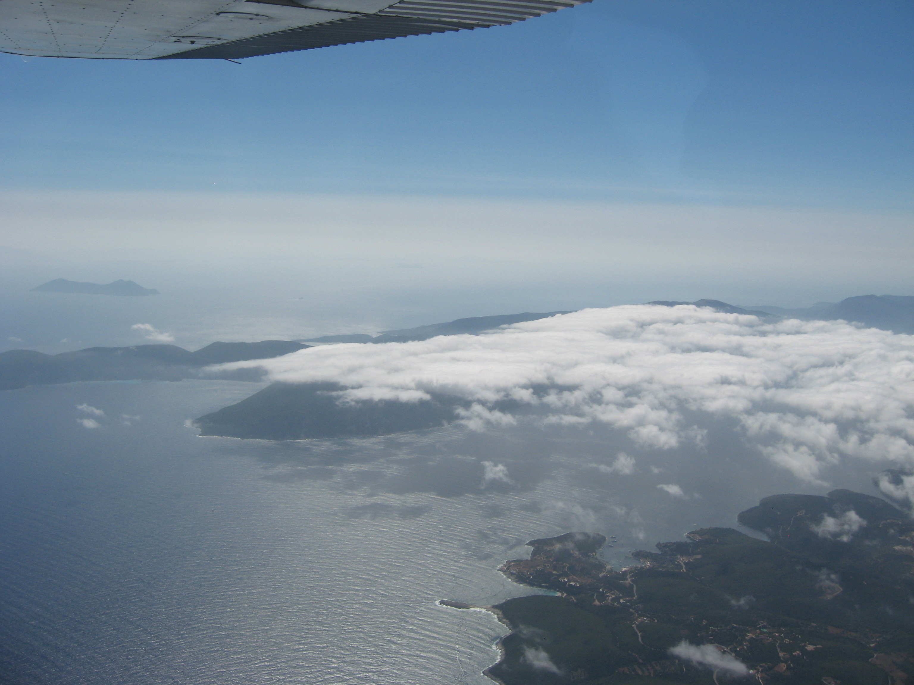
 We were cruising above the most beautiful islands of Croatia, along VFR route ADRIA1. Above each reporting point I stated briefly my position and altitude and the controller acknowledged promptly. In between was plenty of time to enjoy the views. 20nm north-east of Dubrovnik the controller told us we were cleared direct to final, ILS/visual approach runway 12. Well, I didn’t have ILS but since I didn’t see the runway yet I dialed the ILS frequency into the VOR. After a long time a point at the horizon looked like runway 12. I kept the speed up since it was still far away. Descent was not required because our cruising altitude was 1500ft. Good thing there was a precision approach path indicator (PAPI) that reminded me to slow down and descend for landing! 😉 The next day we flew to Greece and passed by Montenegro and Albania.
In Albania no general aviation exists. We didn’t even have charts – except two tactical pilotage charts from 1998. I never thought I would have to use coördinates and all these things asked in the pilot tests. But actually I was quite happy to have
those skills! 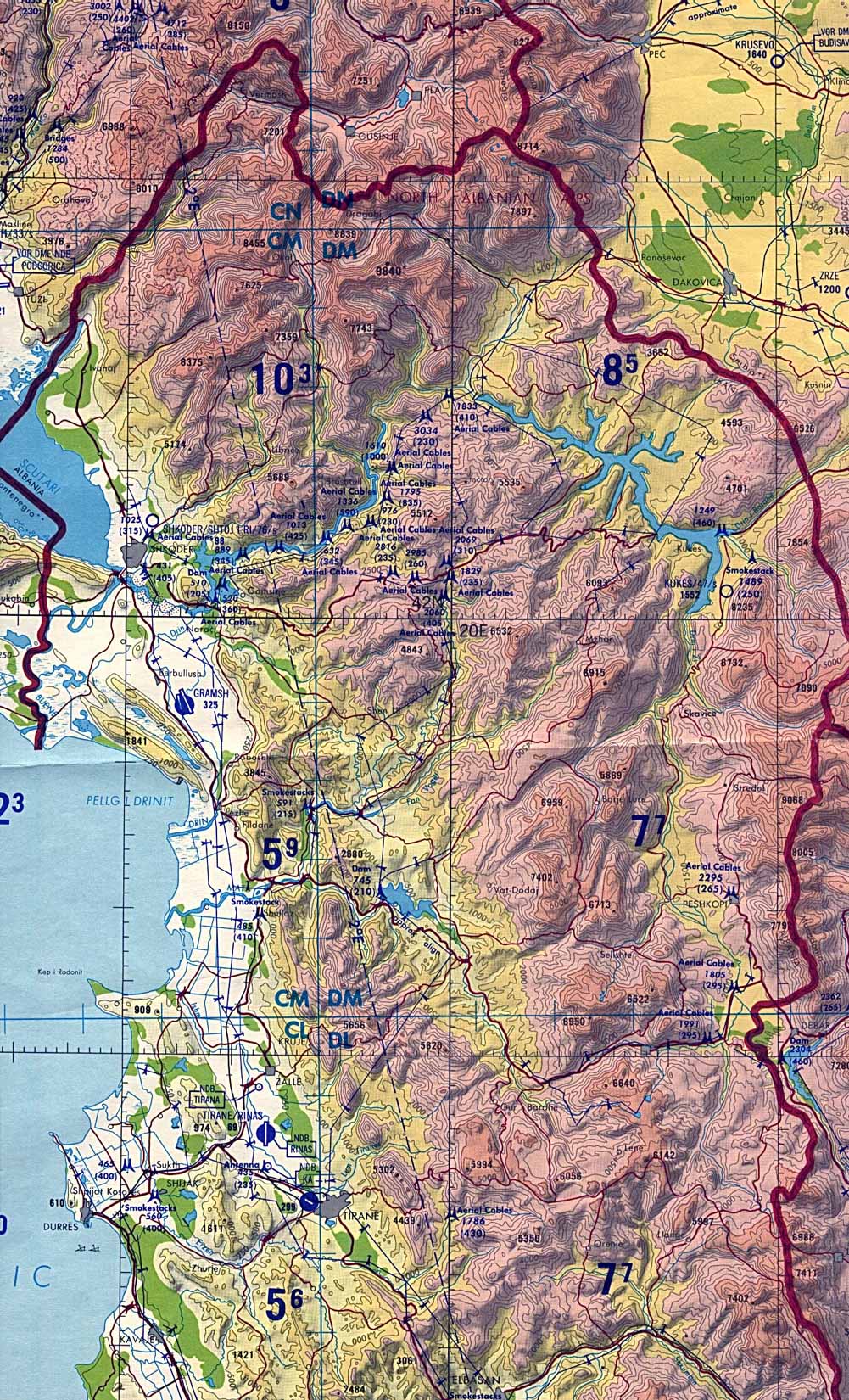
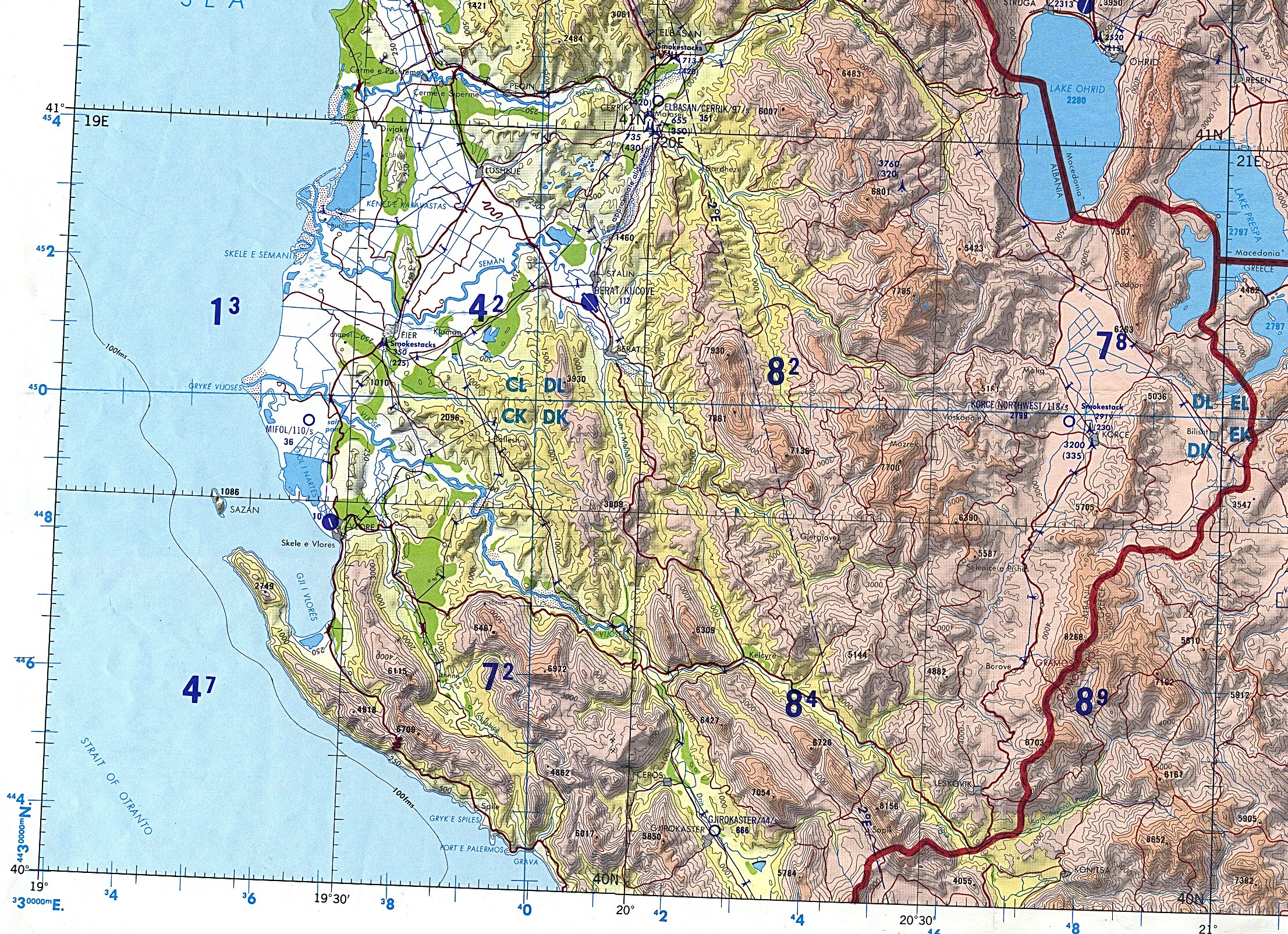 We also had a low-level IFR chart that was useful for all the GPS reporting points the controllers asked for. But since an IFR chart doesn’t depict any landmarks it didn’t help much. I sticked to the outdated maps and made good use of deduced reckoning. My father had his iPad with a moving map but it didn’t show anything on the map either. As you can see on the old charts there are airports. The thing was, though, that since 1998 the airport areas were used for industry – there are no runways anymore. Albania felt very different from the air. Most roads were made by gravel and the fields were long and thin. My girlfriend, she grew up in a farmer family, told us this was an indication that draught cattle or horse were beeing used. I found a survey now that states that in 1999 42% of the farmers in Albania used only draught animals and in the whole country only 7000 tractors were counted (regardless of condition) in the year 2000 (in Switzerland we had about 120’000 tractors in that year). Interesting numbers…
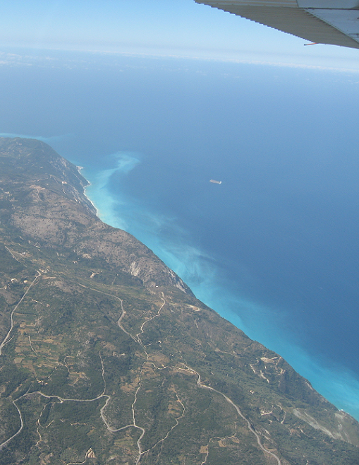
Nevertheless the countryside was beautiful. I remember flying in a climbing valley until we flew over a pass. We flew a long way over the sea and the controller, who wasn’t familiar with VFR flights gave us many instructions. We found out he didn’t have a good radar and probably tried to separate us from other VFR aircraft of our group. The airspace we were flying in was not classified so it wasn’t clear which rules were to apply. But it didn’t matter anyhow – the pilots know they have to see and avoid in visual meteorological conditions and there wasn’t any traffic but a few Swiss old-timer. 😉 We still had to stay at 1500 feet above the sea. It was hot in the cockpit, on the ground about 35°C/95°F, and the cabin crew (girlfriend and mum) fell asleep soon. Even my father asked if I was tired and as soon as I told him I wasn’t he closed his eyes. Now this was a good feeling: Flying across the border to Greece somewhere above the Ionian Sea and all felt safe with me as a pilot. 🙂 My E6-B, plotter and map brought me all the way back into an area where the GPS and moving map became useful again. Though I have to admit that a GPS is still useful as long as it displays your coördinates!